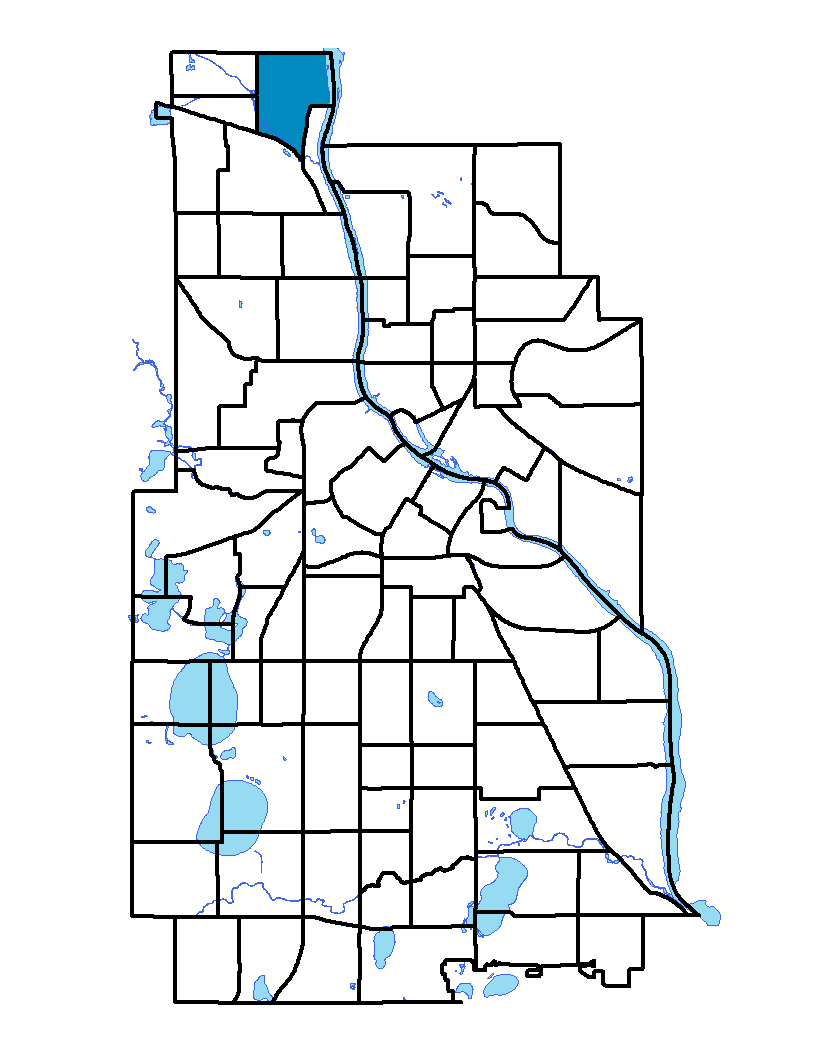
Lind-Bohanon, on Minneapolis' far north side, is bounded on the north by 53rd Avenue North (the city's boundary with Brooklyn Center) and extends east to the Mississippi River. An industrial area eventually comes between Lind-Bohanon and the river, causing the neighborhood's eastern border to shift at 48 th Avenue North to Lyndale Avenue North. This border extends south to the Canadian Pacific Railway tracks. On the west, the neighborhood's boundary is Humboldt Avenue North. Lind-Bohanon covers more than 500 acres and is smaller than one square mile. The neighborhood and its elementary school are named for Jenny Lind, a famous Swedish soprano born in the first half of the 19 th century. The neighborhood has a low resident turnover rate, with some families residing there for two or three generations. The homes are generally modestly priced compared to the rest of Minneapolis.
To learn more about the neighborhood association visit: www.lindbohanon.org
Indicator Details
|
Indicators |
Primary Domain | Indicator Value | Rank | Tier |
|---|---|---|---|---|
| Access to Mainstream Financial Services | Economic Health | 29.0% | 51 | Middle |
| Access to Parks and Open Space | Natural Areas | 8.8% | 30 | Middle |
| Adult Educational Attainment | Educational Opportunities | 87.4% | 50 | Middle |
| Age of Housing | Housing | 78.6% | 29 | Top |
| Blood Lead Levels in Children | Housing | 2.3% | 25 | Top |
| Business Retention | Economic Health | -0.5% | 61 | Bottom |
| Chronic School Absence | Health Systems and Public Safety | 51.2% | 30 | Middle |
| Commute Mode Share | Transportation | 13.9% | 81 | Bottom |
| Employment Rate | Employment Opportunities | 60.8% | 67 | Bottom |
| Excessive Housing Cost Burden | Housing | 30.5% | 52 | Middle |
| Food Desert | Neighborhood Characteristics | 100.0% | 31 | Middle |
| High School Graduation Rate | Educational Opportunities | -% | - | Data N/A |
| Household Transportation Costs | Transportation | 19.1% | 76 | Bottom |
| Local Business Vitality | Economic Health | 46.0% | 66 | Bottom |
| Long-Term Unemployment | Employment Opportunities | 3.3% | 11 | Top |
| Low Birth Weight | Health Systems and Public Safety | 10.2% | 61 | Bottom |
| Motor Vehicle Collisions | Health Systems and Public Safety | 2.6 | 25 | Top |
| Offsite Alcohol Outlets | Neighborhood Characteristics | 1 | 6 | Top |
| Pedestrian Connectivity | Transportation | 184.4 | 11 | Top |
| Preschool Enrollment | Educational Opportunities | 20.2% | 81 | Bottom |
| Preventable Hospitalizations | Health Systems and Public Safety | 8.1 | 70 | Bottom |
| Proximity to Brownfield Sites | Environmental Hazards | 3.7% | 38 | Middle |
| Proximity to Superfund Sites | Environmental Hazards | 0.0% | 1 | Top |
| Public Assisted Households | Employment Opportunities | 33.9% | 64 | Bottom |
| Reading Proficiency | Educational Opportunities | 13.9% | 27 | Top |
| Residential Mobility | Social Cohesion | 83.9% | 25 | Top |
| Residential Proximity to Traffic | Environmental Hazards | 13.4% | 51 | Middle |
| School Proximity to Traffic | Environmental Hazards | 0.0% | 1 | Top |
| School Readiness Scores | Educational Opportunities | -% | - | Data N/A |
| Toxic Releases from Facilities | Environmental Hazards | 39.0% | 60 | Bottom |
| Transit Accessibility | Transportation | 163.4 | 81 | Bottom |
| Travel Time to Work | Employment Opportunities | 24.5 minutes | 78 | Bottom |
| Tree Cover | Natural Areas | 30.3% | 23 | Top |
| Vacancy Rates | Housing | 13.5% | 75 | Bottom |
| Violent Crime | Health Systems and Public Safety | 65.9 | 62 | Bottom |
| Voter Participation | Social Cohesion | 15.5% | 73 | Bottom |
| Walkability | Neighborhood Characteristics | 31 | 80 | Bottom |