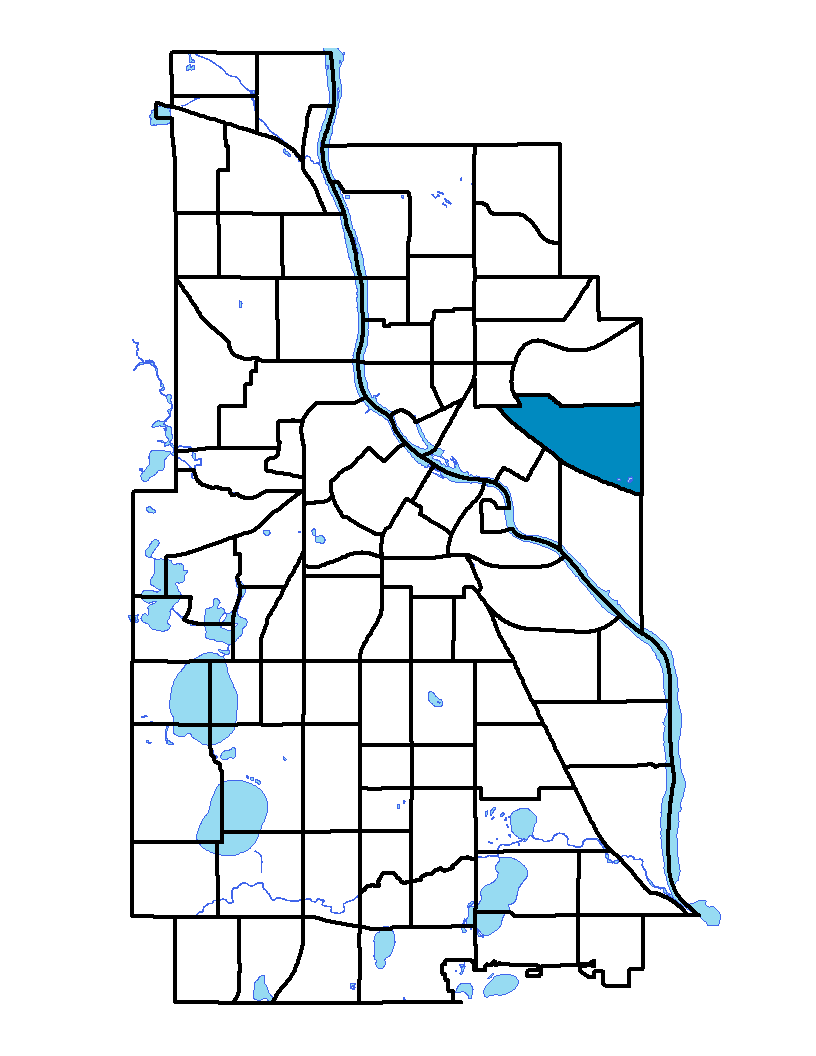
The Como neighborhood (also called Southeast Como) is named after Como Avenue, which runs through the neighborhood. Como Avenue took its name from Lake Como in northern Italy, a popular tourist destination. Como neighborhood is in the University community, about one mile north of the Dinkytown commercial area and the east bank campus of the University of Minnesota. Its boundaries are the city limit to the east (33rd Avenue SE), the Southeast Industrial Area to the south of Elm Street, Interstate 35W and the Burlington Northern main line to the west, and East Hennepin Avenue and Winter Street NE to the north. The housing stock consists of modest early 20th-century bungalows and Victorian and 1920s-era homes with a scattering of newer duplexes and single-family homes. Many of the larger homes have been converted into student housing. Como has an elementary school, three churches, a mosque, Van Cleve Park and small retail stores. The Bunge grain elevator was abandoned in 2003. A plan made public in late 2005 would have locally based Project for Pride in Living, a nonprofit developer, purchase the complex, raze the silos and retain the prominent tower for an owner-occupied mixed-income multifamily residential development.
To learn more about the neighborhood association visit: http://secomo.comogreenvillage.info
Indicator Details
|
Indicators |
Primary Domain | Indicator Value | Rank | Tier |
|---|---|---|---|---|
| Access to Mainstream Financial Services | Economic Health | 30.0% | 54 | Middle |
| Access to Parks and Open Space | Natural Areas | 1.2% | 72 | Bottom |
| Adult Educational Attainment | Educational Opportunities | 95.5% | 26 | Top |
| Age of Housing | Housing | 80.9% | 30 | Middle |
| Blood Lead Levels in Children | Housing | 1.6% | 15 | Top |
| Business Retention | Economic Health | 5.4% | 16 | Top |
| Chronic School Absence | Health Systems and Public Safety | 65.5% | 39 | Middle |
| Commute Mode Share | Transportation | 41.0% | 15 | Top |
| Employment Rate | Employment Opportunities | 75.7% | 12 | Top |
| Excessive Housing Cost Burden | Housing | 45.5% | 76 | Bottom |
| Food Desert | Neighborhood Characteristics | 100.0% | 31 | Middle |
| High School Graduation Rate | Educational Opportunities | -% | - | Data N/A |
| Household Transportation Costs | Transportation | 16.6% | 39 | Middle |
| Local Business Vitality | Economic Health | 44.0% | 73 | Bottom |
| Long-Term Unemployment | Employment Opportunities | 4.4% | 27 | Top |
| Low Birth Weight | Health Systems and Public Safety | 1.8% | 4 | Top |
| Motor Vehicle Collisions | Health Systems and Public Safety | 4.5 | 34 | Middle |
| Offsite Alcohol Outlets | Neighborhood Characteristics | 1 | 6 | Top |
| Pedestrian Connectivity | Transportation | 59.1 | 83 | Bottom |
| Preschool Enrollment | Educational Opportunities | 56.0% | 34 | Middle |
| Preventable Hospitalizations | Health Systems and Public Safety | 8.7 | 71 | Bottom |
| Proximity to Brownfield Sites | Environmental Hazards | 14.6% | 64 | Bottom |
| Proximity to Superfund Sites | Environmental Hazards | 93.3% | 84 | Bottom |
| Public Assisted Households | Employment Opportunities | 12.3% | 31 | Middle |
| Reading Proficiency | Educational Opportunities | -% | - | Data N/A |
| Residential Mobility | Social Cohesion | 59.1% | 81 | Bottom |
| Residential Proximity to Traffic | Environmental Hazards | 12.4% | 48 | Middle |
| School Proximity to Traffic | Environmental Hazards | 0.0% | 1 | Top |
| School Readiness Scores | Educational Opportunities | -% | - | Data N/A |
| Toxic Releases from Facilities | Environmental Hazards | 98.9% | 83 | Bottom |
| Transit Accessibility | Transportation | 378.6 | 30 | Middle |
| Travel Time to Work | Employment Opportunities | 20.9 minutes | 18 | Top |
| Tree Cover | Natural Areas | 26.3% | 62 | Bottom |
| Vacancy Rates | Housing | 6.6% | 36 | Middle |
| Violent Crime | Health Systems and Public Safety | 45.6 | 42 | Middle |
| Voter Participation | Social Cohesion | 11.1% | 83 | Bottom |
| Walkability | Neighborhood Characteristics | 62 | 44 | Middle |

